Revolutionizing Free Space Mapping with Imaging Radar

April 14, 2021
Read Blog

By Ben Rathaus

=== TABLE OF CONTENTS (Q&A Format) ===

1. What is Free Space Mapping and why is it vital for autonomy?
Free Space Mapping is the process of distinguishing drivable areas from non-drivable obstacles. It creates an “occupancy grid” that serves as the foundation for a vehicle’s navigation, path planning, and obstacle avoidance. Without a reliable estimate of empty space, an autonomous vehicle cannot safely determine its trajectory.

2. Why can’t cameras handle Free Space Mapping alone?
While cameras are excellent at identifying textures and boundaries, they are “contrast-based” and lack native depth perception. This makes it difficult for them to accurately measure the distance to a frontal target—especially in low-light, glare, or heavy weather—which is a critical requirement for safe path planning.

3. How does 4D Imaging Radar complement the camera’s weaknesses?
Radar provides highly accurate, direct distance measurements and is completely unaffected by lighting or weather conditions (rain, fog, or darkness). By pairing the camera’s visual detail with the radar’s reliable depth sensing, the vehicle gains a redundant, fail-safe understanding of the road.

4. What is the role of LiDAR in this sensor suite?
LiDAR offers high resolution (0.1°) but struggles in adverse weather and carries a significantly higher cost. Furthermore, driving decisions require wide safety margins where 0.1° vs 1° resolution has a negligible impact. Therefore, Imaging Radar is seen as the primary reliable partner to the camera, with LiDAR acting as a mid-range backup.

5. Why is traditional automotive radar inadequate for mapping?
Traditional radars have a low resolution (5° or worse), which causes objects to appear much larger than they are, blurring their boundaries. They also lack elevation data and often discard stationary objects (like guardrails or parked cars) as “clutter,” making it impossible to generate a reliable occupancy grid.

6. How does Arbe’s radar handle stationary objects differently?
Arbe’s 4D Imaging Radar excels at detecting stationary objects. It can accurately map road geometry, curvature, and fixed hazards like concrete walls or vehicles parked in-lane. It treats the stationary environment as vital data rather than noise to be filtered out.

7. How does high channel count eliminate “Phantom Objects”?
Traditional radars suffer from high false-alarm rates, leading to “phantom” braking. Arbe’s high channel count (2,304 virtual channels) provides superior spatial separation. This allows advanced post-processing to reduce false alarms to nearly zero, ensuring the vehicle only reacts to real threats.

8. What is the “Memory Component” in a free space grid map?
The 2D occupancy map doesn’t just use the current frame; it includes a memory component from previous frames. This increases the confidence level of the map, “washing out” transient noise or multipath reflections and maintaining awareness of areas that might be briefly occluded (hidden).

9. Why is Elevation Resolution the secret to 2D mapping?
Even though the final map is 2D (a bird’s eye view), the system needs the third dimension (elevation) to build it accurately. Without elevation data, a radar cannot distinguish between a road sign (drivable underneath) and a construction barrier (must avoid). Elevation resolution is what makes the 2D map trustworthy.

10. What is the “NVIDIA Update” for 2026?
As of January 2026, Arbe has integrated its 2K ultra-HD radar with NVIDIA DRIVE. This combination uses AI-based Occupancy Grids to process over 20,000 detections per frame, enabling “eyes-off” driving at highway speeds (up to 130 km/h) by providing a highly detailed, real-time map of the vehicle’s surroundings.

=== TL;DR ===

  • Defining Drivable Space: Free space mapping is the “first condition” for autonomy; imaging radar is the only sensor that can reliably perform this task in all-weather, long-range scenarios.
  • Redundancy Over LiDAR: By offering LiDAR-like performance at a radar price point, Arbe’s technology allows for safe L3 and L4 autonomy without the extreme costs and weather-sensitivity of high-end LiDAR units.
  • Stationary Object Mastery: Unlike legacy radar that ignores “clutter,” Arbe’s high resolution allows it to map stationary infrastructure, ensuring the car knows exactly where the road ends and a guardrail begins.
  • Elevation is Essential: High-resolution elevation data is the only way to separate overhead objects (bridges/signs) from road-level obstacles, eliminating the “phantom braking” that plagues current ADAS.
  • The AI-Ready Point Cloud: In 2026, the transition to AI-based Occupancy Grids (via NVIDIA) has turned radar data into a dense, 20,000-point cloud, allowing for human-like navigation and safe highway-speed autonomy.

Imaging Radar is a Key Sensor for Free Space Mapping

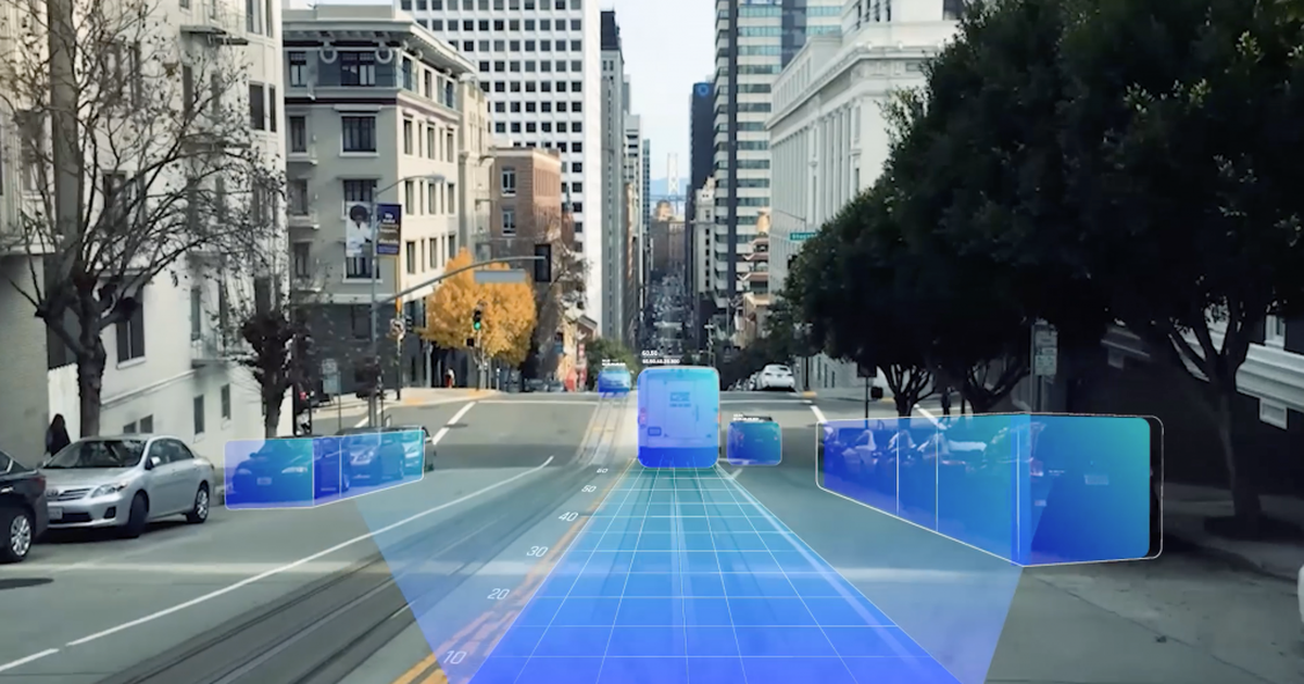
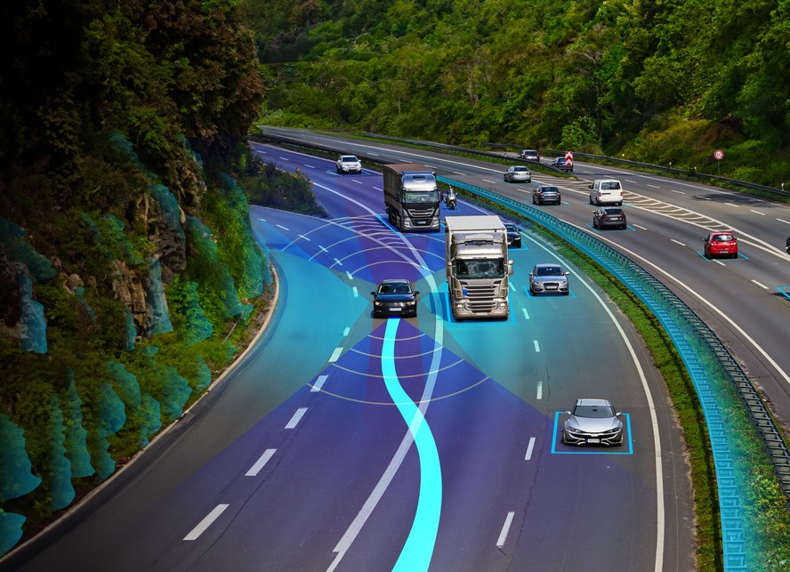
The first necessary condition to support autonomous decision making is to be able to distinguish drivable from non-drivable portions of the immediate driving environment. Free space mapping is the basis for navigation, path planning, and obstacle avoidance, which require a reliable estimate of the empty vs. occupied space in the vehicle’s environment. 

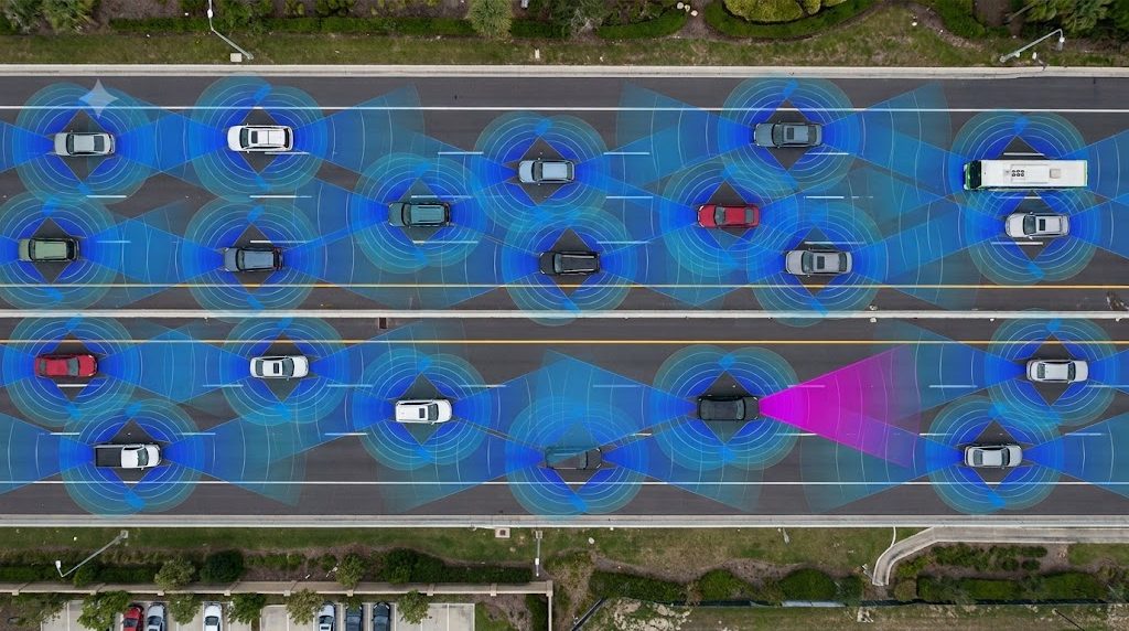
Free space mapping used for vehicle autonomy cannot be performed exclusively with one sensor. The purpose of sensor redundancy is not only to provide a fail-safe mechanism, but also to exploit the individual sensors’ advantages to achieve better coverage. An imaging radar, with its high sensitivity, high-resolution, full spatial sensing (including elevation), and all-weather all-visibility performance, is the perfect candidate to counter the contrast-based free space mapping performed by cameras.

Why is Imaging Radar the Best Sensor to Complement the Camera?

Even though cameras provide adequate azimuth and elevation mapping and are a commonly used sensor for free space mapping, a lack of reliable range resolution or sufficient depth perception results in their inability to accurately measure frontal target distance, a crucial requirement for path planning. Radar, on the other hand, provides highly accurate target distance mapping and is operational in all weather and lighting conditions making it the ideal (and only necessary) complementary sensor to a camera. 

What’s the Role of LiDAR?

LiDAR provides a satisfactory free space solution for mid ranges. Lidar does not measure Doppler directly and must rely on tracking to determine which objects are stationary. Some LiDAR offers ultra-high resolution of 0.1 degree, higher than radar’s 1 degree; however, this does not provide a meaningful impact for free space mapping since driving decisions require wide safety margins and cannot be executed on 0.1 degree separations. Taking into account LiDAR costs and limited functionality in challenging weather conditions, it is better suited as a backup sensor for an imaging radar and camera suite.

Why Not Use a Traditional Automotive Radar?

Low Resolution

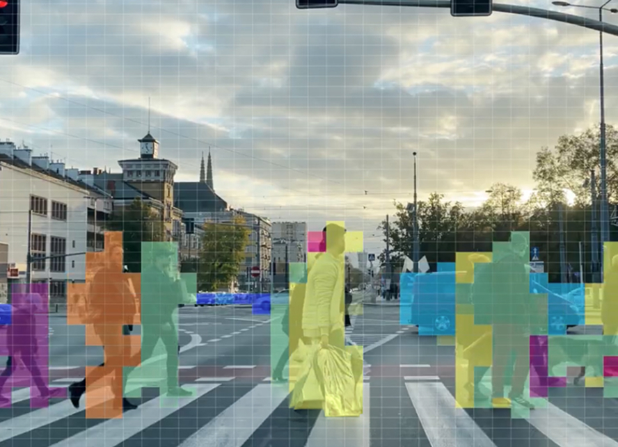
In contrast to the aforementioned 0.1 degree resolution of LiDAR, traditional radar with 5 degree (or worse) resolution are also inadequate for free-space mapping as they cannot provide a detailed enough occupancy grid of their driving scenario. In low resolution radars, objects appear to be much bigger than they actually are, making it impossible to understand their boundaries and exact locations.

Detecting Stationary Objects

Due to their low azimuth resolution and lack of elevation resolution, traditional radars that were originally designed for controlling emergency braking and adaptive cruise control are limited to detecting moving vehicles and typically discard all detections of the stationary environment as clutter. While moving objects can be separated by their Doppler measurements, stationary objects may be unified by mistake into one oversized block, or be discarded.

Arbe’s Imaging Radar, on the other hand, is very effective in detecting stationary objects, determining road geometry and curvature while mapping objects that need to be avoided such as guardrails, concrete walls, vehicles parked in-lane, etc. 

Handling False Alarms

Traditional radars have a high level of false alarms. False alarms trigger radar to report phantom objects and false positives. For this reason, traditional radar-based post-processing algorithms raise the detection threshold, which results in decreased radar sensitivity and may lead to hazardous situations or even accidents.

Superior channel counts that yield improved spatial separation in imaging, such as Arbe’s radar, together with advanced post-processing reduce false alarms with close to zero instances of phantom objects, eliminating both false-positive and false-negative scenarios. This enables the generation of a free-space map the vehicle can rely on.

A Free Space Map Generated by Imaging Radar 

A free space grid map is a 2D occupancy map whose interpretation is a “pixel”-wise probability of being free. This map takes into account current frame information as well as a “memory-component” from previous frames to increase the confidence level of free-space inference, ensuring spurious, false positive detections that are detected despite other noise cleaning algorithms are washed out, and correcting for transient occlusions and multipath reflections.

The Importance of High Elevation Resolution

As mentioned, the free space map is a 2D map, offering a bird’s eye view of the driving environment. In radar terms, this is a range-azimuth map. Each pixel on the map tells us if the corresponding range and azimuth are drivable or not. An important subtlety, however, is that being a 2D output map does not mean that the third spatial dimension, elevation, bears no significance for the ability to reliably map the free space that surrounds the car. In fact, the opposite is true; being able to tell the difference between an obstacle that is irrelevant for driving, such as a road sign, and an obstacle that should be avoided, such as construction-barriers, lies in elevation resolution, which makes imaging radar crucial for free space mapping.

Conclusions

Imaging radar satisfies key requirements for free space mapping, namely high spatial resolution in all dimensions regardless of lighting or weather conditions, at long range with high reliability. Additionally, its complementary high Doppler resolution allows it to distinguish efficiently between stationary and dynamic detections. Together these capabilities make imaging radar a mandatory sensor suite component to map free space in real time.

Connect to learn more
Navigating the Noise
July 5, 2026

Navigating the Noise

Physical AI’s Real Bottleneck Is Perception
June 8, 2026

Physical AI’s Real Bottleneck Is Perception

Why ‘Good Enough’ Detection Fails in the Mine and on the Farm
April 27, 2026

Why ‘Good Enough’ Detection Fails in the Mine and on the Farm

Level 3 Autonomy: The Next Leap in Driving Confidence
November 10, 2025

Level 3 Autonomy: The Next Leap in Driving Confidence

Phantom-Free Radar
August 11, 2025

Phantom-Free Radar

Mastering 20 FPS Performance
July 14, 2025

Mastering 20 FPS Performance